
July 2026 - GPS signal disruptions are ongoing in Pomerania
July 2026 - GPS
signal disruptions
are ongoing
in Pomerania
More than a dozen serious incidents of GPS/GNSS signal jamming in May 2026
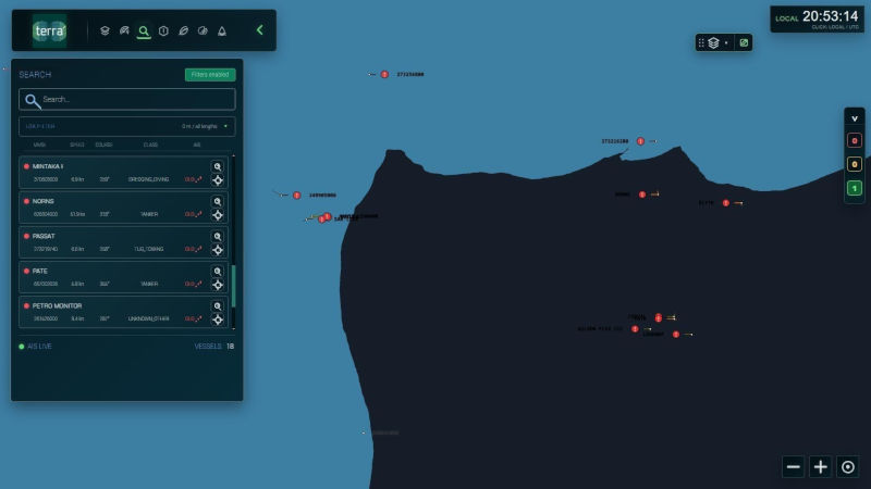
Gdansk, 2nd of June 2026. Blue Dot Solutions’ GPS/GNSS signal monitoring station detected several serious jamming incidents in May 2026. Some of them could have had a significant impact on the functioning of various systems in Pomerania, Poland.
For several years, the Pomeranian region, the southern Baltic region, and much of Poland have been grappling with increasingly frequent GPS/GNSS signal jamming and spoofing. There is virtually no doubt that the source of these jamming incidents is special military units located in the Königsberg Oblast.
The jamming has resulted in a growing number of problems and the partial or even complete inoperability of many devices and systems. GPS/GNSS signal jamming and spoofing no longer only impacts aviation and the military – the Polish Pomeranian region is seeing a rise in incidents affecting civilian operations. Problems with locating vehicles, including bicycles and city buses, are becoming increasingly common, as are loss of control of drones.
In May 2026, the Gdańsk-based company Blue Dot Solutions began regular monitoring of GPS/GNSS signal quality. The first station was installed in Gdańsk, at an altitude of approximately 100 meters above sea level. The selected installation site offers a good view of virtually the entire sky, particularly to the east. The first station monitors signal quality in the L1/G1/E1/B1 and L2/G2/E5/B2 bands for GNSS satellites. This first station is experimental, testing detection algorithms and implementing modifications and updates. Subsequent stations will monitor additional bands using these tested algorithms.

Data acquired by Blue Dot Solutions GNSS interference monitoring system
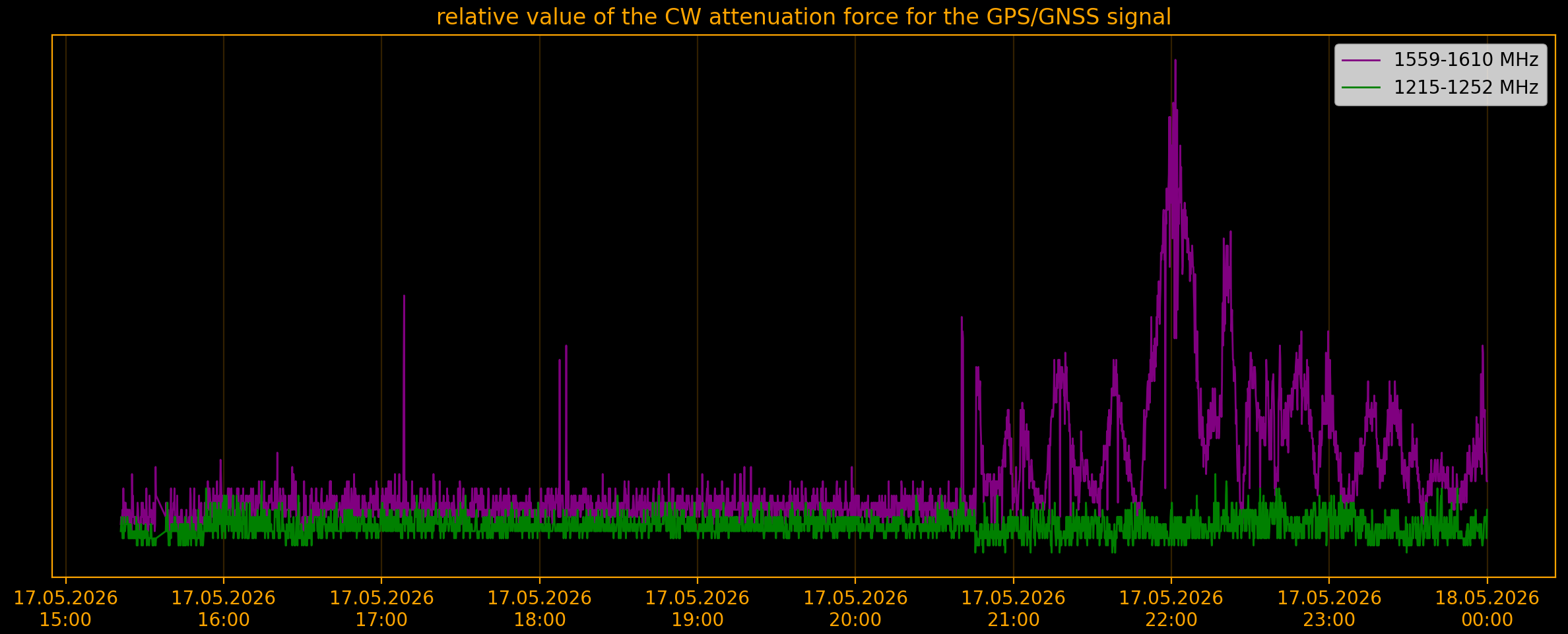
May 17, 2026
Summary of GPS/GNSS jamming incidents in May 2026
The first Blue Dot Solutions station monitored GPS/GNSS signal quality for 624 hours in May. This corresponds to 26 days of operations. The remaining time was spent on software improvements and testing, as well as updating server settings.
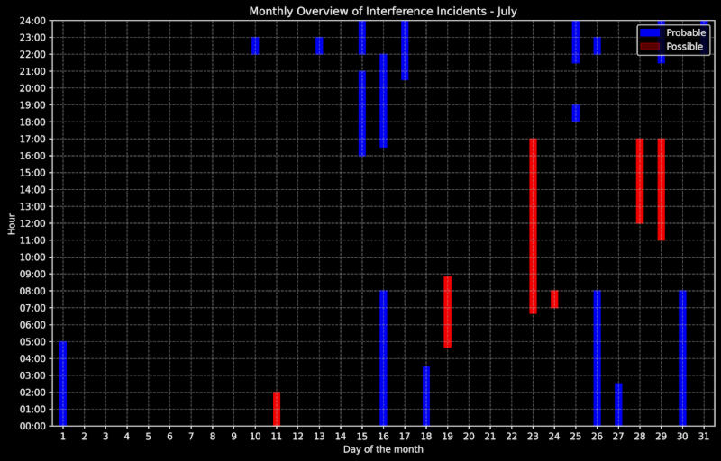
During the entire measurement period, there were nine days when interference incidents were recorded. Most incidents occurred in the second half of May. Additionally, six days with a very high probability of GPS/GNSS signal interference were recorded.
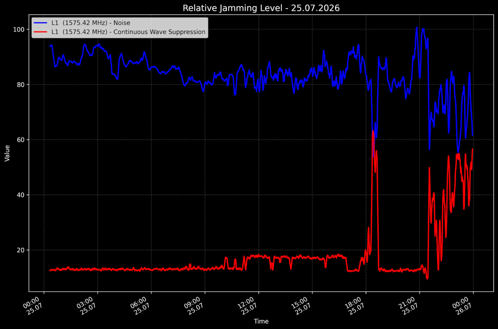
In May 2026, a total of at least 12 serious jamming incidents were identified. Most of them had very similar characteristics. The station typically records an increase in noise levels with a simultaneous increase in continuous wave attenuation and a decrease in signal gain. Typically, these attacks last between a few and dozen hours.
In addition to “typical” GPS/GNSS jamming incidents, the team also detected several unusual incidents. The most serious occurred on May 21, 2026, when we recorded a very unusual increase in the transmitted signal strength on the L2/G2/E5/B2 band. This incident may have been an attempt to disrupt a British government official’s flight from Estonia to the UK. This event clearly demonstrates that intentional signal interference is not uniform and therefore difficult to detect uniformly.

Continuous monitoring begins
In the coming months, the Blue Dot Solutions team plans to install additional monitoring stations. This will allow us to compare incidents and detect instances of local interference with the GPS/GNSS signal. This type of jamming, while also common, is more difficult to detect.
Intentional GNSS signal jamming is a significant problem affecting northern Poland. It affects the operation of public transport, rental cars, and taxis. Interference can also cause problems locating city bikes, which can sometimes be “found” in the Baltic Sea, even off the coast of the Königsberg Oblast. However, these are just clear examples of a very broad problem that our station can help identify and ultimately counteract.
“This first station already demonstrates how sensitive our systems are to various types of GPS/GNSS signal jamming,” explains Dr. Krzysztof Kanawka, CEO of Blue Dot Solutions. “We’ve noticed a clear correlation between incidents and strange readings from digital systems. For example, in May, private users lost at least a dozen drones in Pomerania. What’s more, maps often showed local buses, trams, rental cars, and bicycles in the waters of the Bay of Gdańsk. These types of problems are just the tip of the iceberg – our task in the coming weeks is to connect jamming incidents with problems in digital systems.”
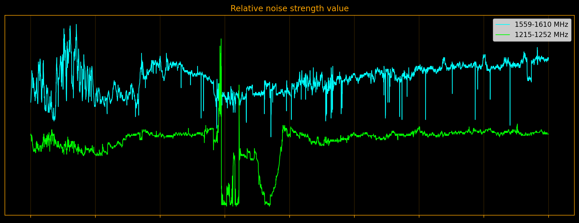
Data acquired by Blue Dot Solutions GNSS interference monitoring system
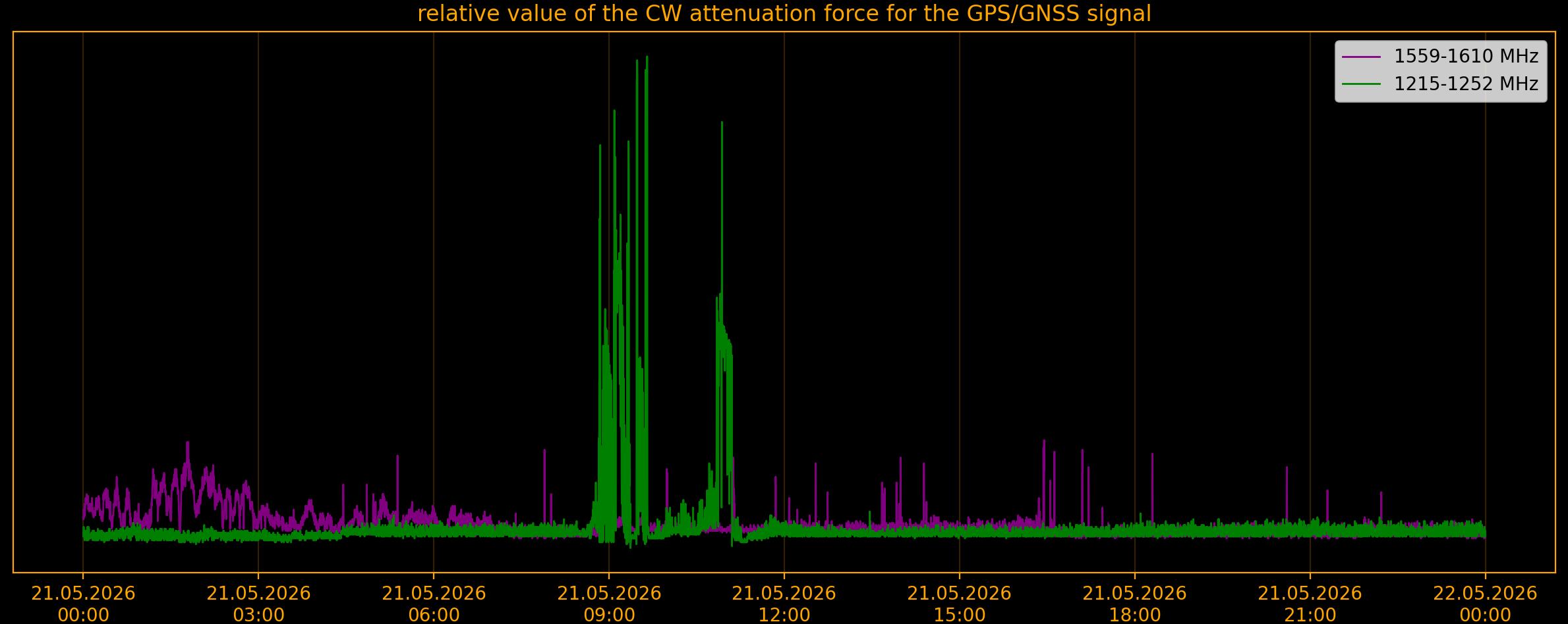
May 21, 2026
Without the written consent of Blue Dot Solutions sp. z o.o., any form of processing, downloading, copying, or collecting data or information posted on this website is prohibited, including web scraping, web crawling, text and data mining (TDM) techniques. These activities also apply to the downloading and analysis of data, indexing of pages, and the use of content in an automated or manual manner, including for the development, construction, training, and improvement of software, machine learning systems, and artificial intelligence.
The exception is activities that facilitate the functioning of search engines, enabling users and search engines to find the content of the website in the correct manner. All rights to the content and data are reserved.
Zabronione są bez pisemnej zgody Blue Dot Solutions sp. z o.o. jakiekolwiek formy przetwarzania pobierania, kopiowania, gromadzenia danych lub informacji zamieszczonych na niniejszej stronie internetowej, wliczając w to techniki web scrapingu, web crawlingu, eksploracji tekstu i danych (TDM). Te działania także dotyczą pobieranie i analizę danych, indeksowanie stron, korzystanie z treści w sposób zautomatyzowany lub manualny, w tym dla rozwijania, budowania, szkolenia i poprawiania oprogramowania, systemów uczenia maszynowego oraz sztucznej inteligencji.
Wyjątek stanowią działania służące do ułatwionego funkcjonowania wyszukiwarek internetowych, umożliwiające użytkownikom oraz wyszukiwarkom odnalezienie treści strony w prawidłowy sposób. Wszelkie prawa do treści i danych są zastrzeżone.